Water Chart for Boaters: How to Read Nautical Charts
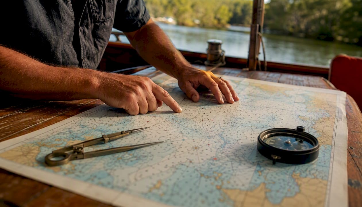
A water chart — the proper term is a nautical chart — is a specialized map built for marine navigation that shows water depths, coastlines, hazards, aids to navigation, and seabed features. The primary official source for U.S. waters is NOAA’s Office of Coast Survey, which publishes raster charts, Electronic Navigational Charts (ENCs), and an interactive catalog covering U.S. coastal waters, the Great Lakes, and U.S. territories. Consumer apps such as i-Boating and the free community-driven viewer OpenSeaMap offer additional options, but official NOAA charts remain the safety-critical baseline.
Quick-start checklist:
- Download the relevant NOAA raster chart or ENC for your area at nauticalcharts.noaa.gov
- Check the chart’s edition date and confirm which Notices to Mariners have been applied
- Pull current tide predictions from NOAA Tides & Currents before departure
- Verify depth units in the chart title block (feet, fathoms, or meters) and the stated datum
Table of Contents
- What is a water chart and how does it differ from a regular map?
- What information does a nautical chart show?
- How do you read depth soundings and chart datum?
- What chart formats are available and which should you use?
- Where do you get up-to-date U.S. nautical charts?
- How do you keep charts current with Notices to Mariners?
- How do you use a nautical chart for safe passage planning?
- Safety and regulatory notes for U.S. waters
- Key Takeaways
- Why chart literacy is the skill most boaters underestimate
- Safeboatingamerica’s chart-reading courses cover what apps cannot teach
- Useful sources
- FAQ
What is a water chart and how does it differ from a regular map?
A nautical chart is not simply a map with water on it. It is a working document designed to be plotted on, measured, and annotated. Road maps show terrain and roads; nautical charts show what lies beneath the surface and what marks the surface for safe passage.
Primary uses include voyage planning, position fixing, hazard avoidance, and cross-checking electronic navigation against a physical reference. NOAA Ocean Service defines a nautical chart as a graphic representation of a marine area that shows water depths, the nature of the bottom, elevations of land, shoreline configuration, and aids to navigation. That definition also carries a legal dimension: most commercial vessels are required to carry current charts in U.S. waters.
Pro Tip: Keep a copy of U.S. Chart No. 1 onboard or saved to your device. It documents every standardized symbol and abbreviation used on U.S. nautical charts, so you can decode an unfamiliar light characteristic or buoy marking on the spot.
What information does a nautical chart show?
Charts pack a large amount of data into a compact space; educators can use high quality, downloadable primary classroom resources to support teaching water cycle basics related to tides and coastal hydrology. Understanding the categories helps you scan a chart quickly and find what matters for your route.
| Category | What You See | Practical Significance |
|---|---|---|
| Depth soundings | Numbers scattered across the water area | Minimum depth at chart datum (MLLW) at that point |
| Depth contours | Dashed or solid lines connecting equal depths | Quick visual of shoaling zones and channels |
| Hazards | Wrecks (W), rocks (asterisk), reefs, shoals | Obstacles to avoid; some are submerged at all tides |
| Aids to navigation (ATONs) | Buoys, beacons, lights with abbreviations | Example: “Fl R 4s” = flashing red light, 4-second period |
| Shoreline features | Marinas, anchorages, ramps, bridges | Bridge clearances shown in feet above MHW |
| Restricted areas | Magenta outlines or hatching | No-wake zones, military areas, marine sanctuaries |
The abbreviation system is standardized across all U.S. charts. When you see “Fl G 2.5s 15ft 4M” next to a buoy symbol, that string tells you the light flashes green every 2.5 seconds, stands 15 feet above water, and is visible for 4 nautical miles. U.S. Chart No. 1 is the authoritative reference for decoding every such abbreviation.
How do you read depth soundings and chart datum?
Charted depths are not the depth you will find when you arrive. They are referenced to a baseline called Mean Lower Low Water (MLLW), which represents the average of the lowest daily tide over a 19-year tidal epoch. Actual depth at any moment equals the charted sounding plus the current tide height.
Practical guides confirm that misreading this relationship is one of the most common causes of groundings. Follow these steps in order:
- Confirm the datum — U.S. charts almost universally use MLLW. The title block states this explicitly.
Pro Tip: Never treat a charted sounding as the depth you will find at low tide. A sounding of 4 feet with a 0.5-foot negative tide and a 3-foot draft leaves you aground. Always run the calculation before committing to a shallow passage.
For a deeper look at boat navigation methods and tools, including how to integrate chart data with GPS fixes, Safeboatingamerica’s navigation guide covers the full workflow.
What chart formats are available and which should you use?
Four formats cover most U.S. boating situations. Each has a distinct role.
| Format | Description | Best Use |
|---|---|---|
| Paper chart | Printed on waterproof or standard stock | Backup, planning table, legal carriage |
| Raster chart | Scanned image of paper chart (NOAA RNC) | Familiar look; zoom degrades detail |
| ENC (vector) | Object-based digital chart; queryable symbols | Chartplotters, ECDIS; detail improves on zoom |
| Consumer app | i-Boating, OpenSeaMap, etc. | Route scouting, supplemental reference |
ENCs distributed by NOAA store each buoy, sounding, and light as a separate queryable object. Tap a symbol on a compatible chartplotter and you retrieve its full metadata: light characteristics, depth, and update history. That object-level detail is a genuine advantage over raster images, where zooming in simply enlarges pixels.
OpenSeaMap is a free, community-contributed chart viewer useful for exploring unfamiliar areas. i-Boating offers a paid consumer app with offline capability. Both are reasonable supplements for recreational planning. Neither replaces official NOAA charts for safety-critical decisions, because update cadence and data sourcing differ from the official distribution pipeline.
Where do you get up-to-date U.S. nautical charts?
Official sources are the only reliable starting point. Third-party resellers and app stores may carry older editions.
- NOAA Office of Coast Survey: Primary portal for raster charts (RNC), ENCs, and the interactive catalog. Free downloads for all formats.
- NOAA Interactive Catalog: Search by chart number or geographic area; view edition dates and applied Notices to Mariners before downloading.
- ENC distribution endpoint: Direct download of current ENC cells for chartplotter loading or ECDIS use.
How do you keep charts current with Notices to Mariners?
Charts change. New wrecks appear, buoys are repositioned, channels are dredged, and restricted areas are established. A chart that was accurate last season may carry outdated depth data or missing hazards today.
The correction system works as follows:
- ENC updates: — Downloaded automatically through NOAA’s distribution service when your chartplotter or software checks for updates; each ENC cell carries a version timestamp.
Check the NOAA Interactive Catalog to confirm which Notices have been applied to a specific chart edition before you download or print it.
Key compliance note: Federal regulations require most commercial vessels operating in U.S. waters to carry current nautical charts. Recreational boaters are not subject to the same mandatory carriage rule, but using an outdated chart in a grounding incident can affect liability determinations. Current charts are a safety and legal best practice for all mariners.
How do you use a nautical chart for safe passage planning?
A structured pre-departure routine reduces risk significantly. Follow these steps before and during any voyage:
- Select the appropriate chart scale — Use a small-scale (wide-area) chart for overall passage planning and a large-scale (detailed) chart for harbor approaches and anchorages.
- Plot your intended route. Draw the track in pencil on paper or enter waypoints in your chartplotter. Reference compass rose use and plotting techniques to convert bearings accurately.
Pro Tip: Record your actual depths at key waypoints in pencil on the paper chart or in a voyage log. Comparing observed depths to charted soundings over time reveals local shoaling that has not yet appeared in official updates.
Pairing chart skills with a full boat safety equipment checklist before departure covers both the navigation and the gear side of trip preparation.
Safety and regulatory notes for U.S. waters
- Commercial vessels: — Federal law generally requires current nautical charts (paper or electronic) to be carried and used in U.S. waters. Verify specific requirements with the U.S. Coast Guard for your vessel class and operating area.
- Recreational boaters: — No federal mandatory carriage requirement applies, but carrying updated charts and applying current corrections is strongly recommended practice and may affect liability in an incident.
This article provides general navigational information, not legal or professional maritime advice. Confirm current regulations with the U.S. Coast Guard or a qualified maritime professional.
Key Takeaways
A nautical water chart shows datum-referenced depths (MLLW), hazards, and aids to navigation; actual safe depth requires adding current tide height to every charted sounding before you commit to a route.
| Point | Details |
|---|---|
| Definition and source | A nautical chart shows depths, hazards, and ATONs; download official charts free from NOAA at nauticalcharts.noaa.gov. |
| Datum and tide calculation | Charted depths reference MLLW; add current tide height from NOAA Tides & Currents to get actual depth. |
| Keep charts current | Check edition dates and apply Local Notices to Mariners; ENC cells update automatically through NOAA’s distribution service. |
| Use both formats | Carry a current paper chart as backup alongside any electronic chartplotter or app for redundancy. |
| Safeboatingamerica training | Safeboatingamerica’s state-approved courses teach chart reading, tide calculations, and practical navigation skills hands-on. |
Why chart literacy is the skill most boaters underestimate
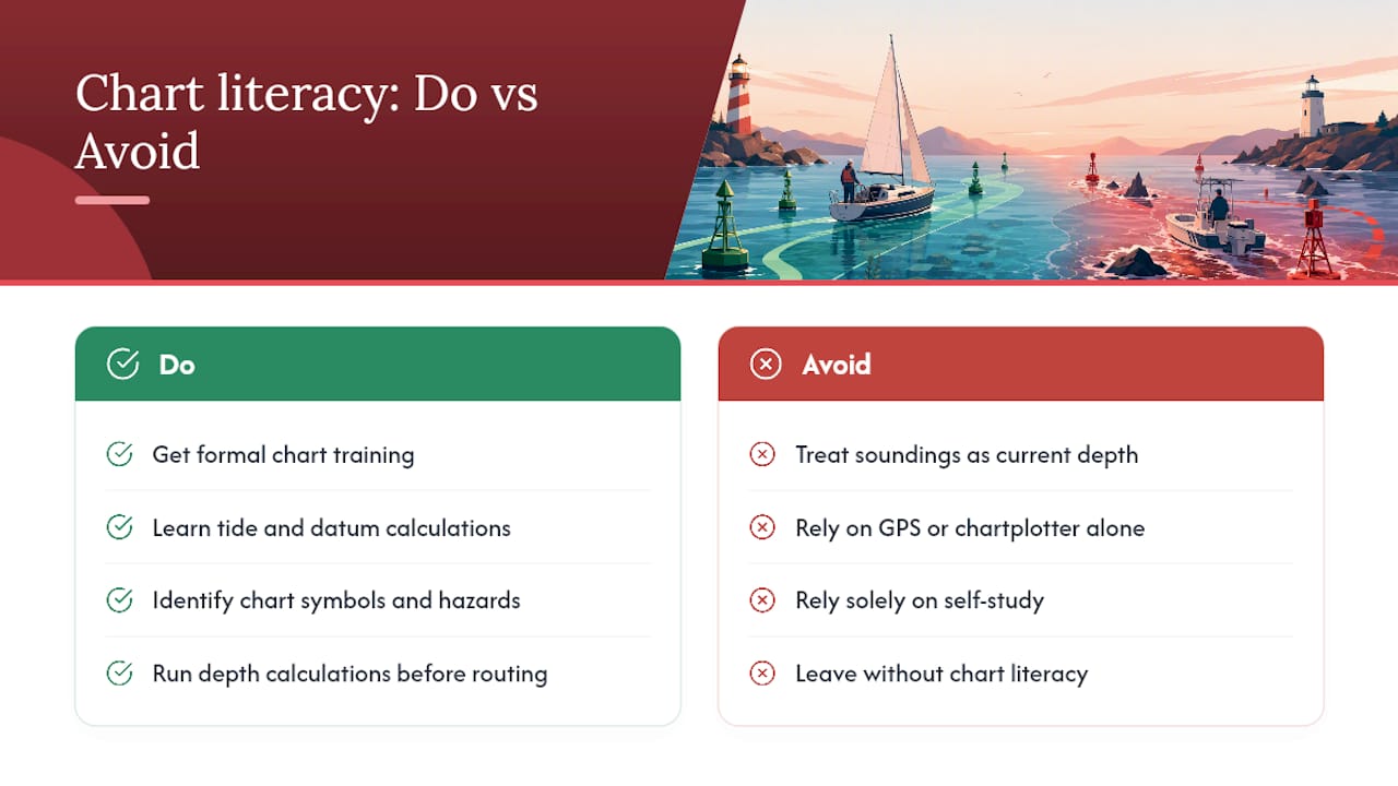
Most grounding incidents do not happen because a boater ignored a chart. They happen because the boater looked at the chart and misread it, usually by treating a sounding as a current depth rather than a datum-referenced baseline. That single misunderstanding is responsible for a disproportionate share of preventable groundings in U.S. coastal waters.
The technology gap makes this worse, not better. Chartplotters and phone apps have made it easier to see where you are, but they have not made it easier to understand what the numbers mean. A GPS track on a screen does not tell you whether the 4-foot sounding ahead is safe at your current tide stage. That calculation still requires the same knowledge it always has.
Formal training closes this gap faster than self-study. When you work through tide calculations, datum concepts, and chart symbol identification with a qualified instructor, the knowledge sticks in a way that reading a guide does not replicate. Safeboatingamerica’s courses, taught by USCG-Licensed Captains and State Certified Instructors using NASBLA-approved materials, cover chart reading as part of a complete navigation curriculum, not as an afterthought. The result is a boater who can pick up any NOAA chart, identify the relevant hazards, run the depth calculation, and make a confident routing decision.
Chart literacy is not advanced seamanship. It is the baseline every boater should have before leaving the dock.
Safeboatingamerica’s chart-reading courses cover what apps cannot teach
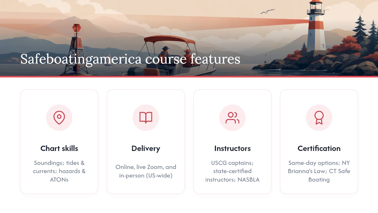
Reading a nautical chart correctly takes more than downloading the right app. Safeboatingamerica’s state-approved boating safety courses teach practical chart skills, including how to interpret soundings, apply tide and current data, identify hazards and ATONs, and plan a safe passage, alongside navigation rules, emergency procedures, and required safety equipment.
Courses are available online, via live Zoom, and in person across the United States, taught by USCG-Licensed Captains and State Certified Instructors using NASBLA-approved materials. Same-day certification options and flexible scheduling make it straightforward to get certified without disrupting your schedule. Whether you need a New York Brianna’s Law-compliant course, a Connecticut Safe Boating Certificate, or a state-approved license for any other state, Safeboatingamerica offers a format that fits.
Register for a boating safety course at Safeboatingamerica and get the chart-reading skills that keep you and your crew safe on the water.
Useful sources
Official resources for U.S. nautical charts, tide data, and symbology references:
- Nautical charts - NOAA Ocean Service
- NOAA Nautical Charts
- charts.noaa.gov Interactive Catalog
- distribution.charts.noaa.gov
- NOAA Tides & Currents
- U.S. Chart No. 1 (symbology reference)
- How to Read Marine Charts: A Practical Guide | RepairYachts
- Ultimate Guide to Nautical Chart Navigation - Improve Sailing
FAQ
What is a water chart?
A water chart is a nautical chart: a specialized navigation map showing water depths, hazards, aids to navigation, and shoreline features. NOAA Ocean Service defines it as a graphic representation of a marine area used to plan and execute safe voyages.
Is there a map that shows water depth?
Yes. NOAA nautical charts display depth soundings (individual numbers) and depth contour lines referenced to Mean Lower Low Water (MLLW). Download them free at nauticalcharts.noaa.gov.
How do you read a water depth chart?
Identify the sounding number at your location, confirm the units (feet, fathoms, or meters) in the chart title block, then add the current tide height from NOAA Tides & Currents to get actual depth. Subtract your vessel’s draft plus a safety margin before committing to a shallow passage.
What does it mean to chart waters?
To chart waters means to survey and record depth, hazard, and navigational data for a body of water and publish it as an official nautical chart. In the U.S., NOAA’s Office of Coast Survey is responsible for charting coastal waters, the Great Lakes, and U.S. territories.
Do recreational boaters need to carry a nautical chart?
Federal law mandates current chart carriage for most commercial vessels; recreational boaters face no equivalent federal requirement. Carrying an updated chart is strongly recommended practice and can affect liability in a grounding incident.