

Boat Navigation: Methods, Tools & Safety Guide
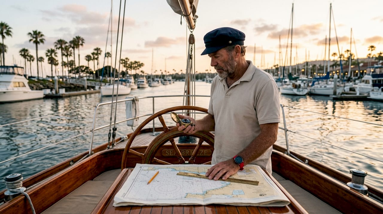
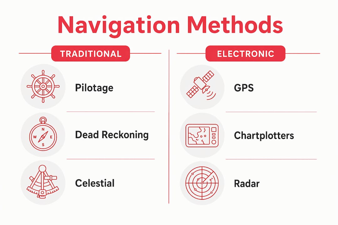
Boat navigation is the practice of determining your vessel’s position and directing its course safely over water using four core methods: pilotage, dead reckoning, electronic navigation, and celestial navigation. Each method has a distinct role, and skilled mariners combine all four rather than relying on any single approach. The standard industry term is marine navigation, though “boat navigation” is the phrase most recreational boaters search for. Essential tools range from a magnetic compass and nautical charts to GPS chartplotters, depth sounders, and apps like Navionics. The Furuno NavNet TZtouch E series represents the professional end of modern marine navigation systems, integrating radar, AIS, and 4K displays into one platform.
What tools are essential for boat navigation?
Safe passage requires at minimum a magnetic compass, nautical charts, a GPS chartplotter, and a depth sounder. Each instrument fills a specific gap the others cannot cover.
- Magnetic compass: The compass is the one instrument that works without power, signal, or software. Every vessel should carry one regardless of how advanced its electronics are.
- Nautical charts: Charts provide critical data including water depths, hazards, channel boundaries, and navigation aids. GPS coordinates alone cannot tell you what is beneath your hull.
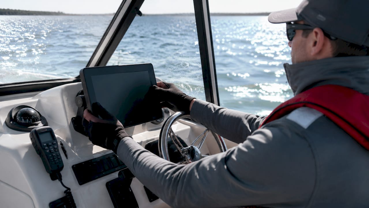
- GPS chartplotter: A chartplotter overlays your real-time position on an electronic chart. It lets you set waypoints, build routes, and track your course over ground with precision.
- Depth sounder: A depth sounder measures water depth in real time. It is your primary defense against grounding in unfamiliar or shallow waters.
- Marine navigation apps: Apps like Navionics deliver SonarChart HD bathymetry with detail down to 1 foot, plus Auto Guidance+ for route planning with ETA and fuel consumption estimates. Many also integrate weather, tides, and marine traffic alerts.
- Radar and AIS: Professional systems like the Furuno NavNet TZtouch E series combine radar, AIS, and sonar into a single display. AIS integration provides real-time traffic awareness with auditory and visual collision alerts on crowded waterways.
Pro Tip: Before any offshore trip, download offline chart tiles in your marine navigation app. Cell coverage disappears fast once you leave the harbor, and an app without offline data is just a screen.
How do traditional methods compare to electronic systems?
Traditional and electronic navigation each have strengths the other lacks. Understanding both is what separates a competent mariner from someone who is one dead battery away from being lost.
| Method | Strengths | Limitations | Best Use Case |
|---|---|---|---|
| Pilotage | No equipment needed; uses visible landmarks | Only works near shore with clear visibility | Harbor entry, coastal cruising |
| Dead reckoning | Works anywhere, no signal required | Errors accumulate over time and distance | Short offshore legs between fixes |
| GPS / Chartplotter | Precise, continuous, real-time position | Vulnerable to battery failure, glare, signal loss | Primary navigation on all trips |
| Celestial navigation | Fully independent of electronics | Requires training, clear skies, and time | Offshore backup; specialized passages |
Experienced mariners treat compass and paper charts as non-negotiable backups because electronics fail due to battery drain, screen glare, or software glitches. That fact is not a knock on technology. It is a reminder that redundancy is the foundation of safe marine navigation.
Dead reckoning deserves more respect than most recreational boaters give it. The technique uses your known starting position, heading, speed, and elapsed time to estimate your current location. It requires no signal and no power beyond a watch and a compass. Practiced regularly, it sharpens your spatial awareness in ways that staring at a chartplotter screen never will.
Celestial navigation sits at the specialized end of the skill spectrum. It uses a sextant to measure the angle between a celestial body and the horizon, then cross-references almanac tables to calculate position. Few recreational boaters need it, but offshore passage makers treat it as a critical backup when GPS is unavailable or compromised.
Pro Tip: Run a dead reckoning estimate alongside your GPS on every trip. When the two diverge significantly, investigate immediately. It is one of the fastest ways to catch a current or wind drift you did not account for.
What are the latest advances in marine navigation technology?
Marine navigation technology in 2026 has moved well beyond basic GPS. The current generation of systems combines multiple sensors, high-resolution displays, and data layers that were unavailable to recreational boaters just five years ago.
The Furuno NavNet TZtouch E series illustrates where professional marine navigation systems now stand. It offers 4K displays with multi-sensor fusion combining radar, AIS, and sonar, with weatherproof ratings of IPX6 and IPX7. That level of protection matters on a working vessel where spray and rain are constants, not exceptions.
Key advances worth knowing:
- AI Routing: Some chartplotters now calculate routes that account for your vessel’s draft, tide state, and known hazards automatically. The system rejects paths that would put your keel in danger before you even leave the dock.
- Oceanographic data layers: Apps built on the TimeZero platform integrate sea surface temperature and altimetry layers directly into the chart view. These layers are particularly useful for offshore fishing and passage planning in variable current zones.
- GPS-denied navigation: Signal jamming and spoofing are growing threats in certain maritime regions. Sensor fusion technology combining IMU, radar, and cameras now provides reliable positioning when GPS is unavailable or compromised. This is no longer a military-only concern.
- Interface design: Touchscreen displays are intuitive in calm conditions, but physical controls outperform touchscreens under rough or wet conditions. The best systems offer both, letting you switch based on conditions.
| Feature | Traditional System | Modern System (2026) |
|---|---|---|
| Display resolution | Standard LCD | 4K with anti-glare coating |
| Sensor integration | Single (GPS only) | Multi-sensor: radar, AIS, sonar |
| Route planning | Manual waypoints | AI Routing with draft and hazard input |
| Backup positioning | Compass only | Sensor fusion (IMU, radar, camera) |
| Weather data | Separate VHF radio | Integrated real-time overlays |
How can boaters apply navigation skills for safe vessel operation?
Knowing the tools is one thing. Applying them correctly under real conditions is what keeps you safe. Here is a practical framework for integrating traditional skills with modern technology on every trip.
-
Plan your route before departure. Use a marine navigation app like Navionics or a chartplotter to build your route on the chart. Check water depths against your vessel’s draft. Most boating apps allow you to input vessel draft so the system automatically flags shallow sections and adjusts routing to avoid grounding hazards.
-
Cross-reference your chart with current conditions. Tides shift channel depths significantly. A route that is safe at high tide can put you aground at low tide. Check tidal predictions in your app and adjust departure times accordingly.
-
Set up redundancy before you leave the dock. Carry a paper chart of your operating area and a handheld compass as backups to your electronic systems. If your chartplotter loses power mid-passage, you need to know how to use both.
-
Monitor environmental conditions continuously. Apps with integrated weather overlays let you track wind, wave height, and storm cells in real time. Check conditions every 30 minutes on longer passages, not just at departure.
-
Adjust your interface to conditions. In calm harbor waters, a touchscreen chartplotter is fast and convenient. In rough offshore conditions with wet hands, switch to physical controls. Touchscreen interfaces become unreliable when spray is constant and your hands are wet.
-
Invest in formal navigation education. Reading about nautical navigation and practicing it are different skills. Certified boating safety courses cover navigation rules, chart reading, and emergency procedures in structured formats that self-study rarely matches.
For group trips and charter outings, understanding how professional operators plan routes adds another layer of practical knowledge. Resources like group boat tour guides show how experienced captains apply these same navigation principles at scale.
Pro Tip: Screenshot your planned route on your phone before departure. If your primary device fails, you still have a static reference image showing your intended track, waypoints, and key hazards.
Key takeaways
Effective boat navigation requires mastering both traditional methods and modern electronic systems, because no single tool or technique is reliable in every condition.
| Point | Details |
|---|---|
| Four core methods | Pilotage, dead reckoning, GPS/electronic, and celestial navigation each serve a distinct purpose. |
| Redundancy is mandatory | Always carry a magnetic compass and paper charts as backups to electronic systems. |
| Input your vessel draft | Use apps like Navionics to enter your draft and automatically avoid shallow-water grounding hazards. |
| Modern systems fuse sensors | Platforms like Furuno NavNet TZtouch E combine radar, AIS, and sonar for real-time hazard detection. |
| Education closes the gap | Formal boating safety certification builds the navigation competence that technology alone cannot provide. |
What i have learned after years on the water
The most dangerous boater is not the one with outdated equipment. It is the one who trusts their chartplotter so completely that they stop looking out the window.
I have watched experienced skippers freeze when their GPS chartplotter went dark mid-channel because they had never practiced dead reckoning and had no paper chart aboard. The technology did not fail them. Their preparation did.
The shift I have seen in marine navigation over the past decade is genuinely impressive. AI routing, sensor fusion, and oceanographic overlays have made trip planning faster and more accurate than anything available to recreational boaters before. But the boaters who use these tools best are always the ones who understand what is happening underneath them. They know how to read a nautical chart. They understand tidal effects on depth. They can hold a compass bearing when the screen goes dark.
My honest recommendation: learn the traditional skills first, then layer the technology on top. A chartplotter in the hands of someone who understands dead reckoning and pilotage is a force multiplier. In the hands of someone who skipped those fundamentals, it is a false sense of security.
Formal certification courses are the fastest path to building that foundation correctly. They cover navigation rules, chart reading, and emergency procedures in a structured sequence that self-study rarely replicates. The boating safety education requirement exists for exactly this reason.
— Richard
Build your navigation skills with Safeboatingamerica
Strong boat navigation starts with a solid education in the rules, tools, and techniques that keep you and your crew safe on the water.
Safeboatingamerica is a nationally recognized leader in boating safety education, offering NASBLA-approved courses taught by USCG-Licensed Captains and State Certified Instructors. Courses cover navigation rules, chart reading, hazard avoidance, emergency procedures, and required safety equipment. Options include online courses, live Zoom classes, and in-person programs available in every U.S. state. Whether you need a boating safety certification for New York, Connecticut, Florida, California, or any other state, Safeboatingamerica delivers same-day certification options with convenient scheduling. Start your certification today and put the skills behind the technology.
FAQ
What are the four main methods of boat navigation?
The four foundational methods are pilotage, dead reckoning, electronic navigation using GPS and chartplotters, and celestial navigation. Each method serves a different scenario, and skilled mariners use all four depending on conditions.
What is the difference between a nautical chart and a GPS chartplotter?
A nautical chart is a detailed map of a body of water showing depths, hazards, and navigation aids. A GPS chartplotter overlays your real-time vessel position onto that chart, but the underlying chart data is what makes the system useful.
Do i still need paper charts if i have a marine navigation app?
Yes. Electronics can fail due to battery drain, glare, or software issues. Paper charts and a magnetic compass are mandatory backups that function without power or signal.
What is dead reckoning in nautical navigation?
Dead reckoning is the practice of estimating your current position using your last known position, heading, speed, and elapsed time. It requires no electronics and remains a critical skill when GPS is unavailable.
How does vessel draft affect route planning?
Vessel draft is the depth your hull extends below the waterline. Entering your draft into a navigation app allows the system to flag and reroute around shallow areas that would cause grounding, a safety feature standard charts do not provide automatically.
Recommended
- Boat Safety Equipment: What Every Boater Must Carry - Safe Boating America
- Boat Trailering Checklist: Your Complete Safety Guide - Safe Boating America
- Boat Requirements: What Every U.S. Boater Must Know - Safe Boating America
- What is boating safety education: your guide to certification - Safe Boating America