Gale Warning: What Boaters Need to Know and Do
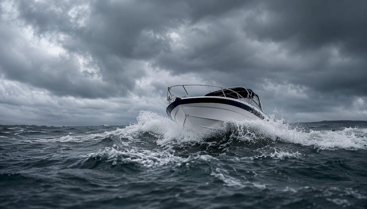
A gale warning is an official marine alert issued by the National Weather Service for sustained surface winds or frequent gusts of 34–47 knots (39–54 mph) not associated with tropical cyclones. If you are on the water or planning to go out, act immediately:
- Leave the water and return to port before conditions deteriorate.
- Seek safe harbor or a protected anchorage now.
- Cancel or postpone any planned departure until the warning is lifted.
- If already underway on a small recreational vessel, head to shore without delay.
Threshold at a glance: 34 knots / 39 mph is the lower boundary. At 47 knots / 54 mph, you are at the upper edge of gale-force winds — conditions that can capsize small boats and snap dock lines.
Key Takeaways
A gale warning means sustained winds of 34–47 knots (39–54 mph) are imminent or occurring in marine zones, and the correct response for recreational boaters is to seek safe harbor immediately.
| Point | Details |
|---|---|
| Official threshold | NWS defines a gale warning as 34–47 knots (39–54 mph), marine zones only. |
| Immediate action | Leave the water or seek safe harbor before conditions reach the lower threshold. |
| Alert channels | Monitor NOAA Weather Radio, VHF Channel 16, and the NWS Active Alerts portal. |
| Warning vs. watch | A gale watch means conditions are possible; a gale warning means they are imminent or occurring. |
| Safeboatingamerica | State-approved courses cover weather literacy, emergency procedures, and VHF communication for gale preparedness. |
Table of Contents
- What the official U.S. definition actually says
- Where and when gale warnings apply
- How you will receive a gale warning alert
- What a gale warning means for your vessel
- How a gale warning differs from related products
- Before, during, and after a gale: your checklist
- Historical gale events that show what these conditions produce
- Where gale warnings fit in the marine warning system
- What experienced instructors know that most boaters overlook
- Formal boating safety training builds gale-condition readiness
- Sources
- FAQ
What the official U.S. definition actually says
The National Weather Service defines a gale warning as a marine product for sustained surface winds or frequent gusts of 34 to 47 knots (39–54 mph) that are not directly associated with tropical cyclones. It is a marine-only product, meaning it applies to coastal and offshore waters, not to land areas.
The Beaufort scale maps gale-force winds to Force 8 (34–40 knots, fresh gale) and Force 9 (41–47 knots, strong gale). Both produce high waves, reduced visibility from spray, and severely limited maneuverability for most recreational vessels.
| Wind Speed | Knots | MPH | km/h | Beaufort Force |
|---|---|---|---|---|
| Lower gale threshold | 34 kt | 39 mph | 63 km/h | Force 8 |
| Mid-range gale | 41 kt | 47 mph | 39 mph | Force 9 |
| Upper gale threshold | 47 kt | 54 mph | 54 mph | Force 9 |
The NOAA NWS Glossary provides the authoritative definitions for gale, gale warning, and gale watch, and is the reference point for any terminology question.
Where and when gale warnings apply
Gale warnings are issued for marine zones only. Typical coverage areas include:
- Coastal ocean waters (Atlantic, Pacific, Gulf of Mexico)
- The Great Lakes
- Sounds, bays, and estuaries under NWS marine forecast jurisdiction
- Inland lakes and waterways covered by specific NWS marine zones
On land, the equivalent product is a high wind warning, issued by local NWS forecast offices. Typical thresholds run around sustained winds of 40 mph or gusts of 58 mph, though criteria vary by region.
Duration is event-dependent. A gale warning may last a few hours for a fast-moving frontal system or persist for 24–48 hours during a slow-moving low-pressure system. Check the NWS Active Alerts page for current status and expected end times.
How you will receive a gale warning alert
Mariners have multiple channels to monitor. Each serves a different purpose.
| Channel | What It Provides | Best Use |
|---|---|---|
| NWS Marine Forecasts | Zone-specific wind, wave, and hazard text | Pre-departure planning |
| NOAA Weather Radio | Continuous broadcasts on 162.400–162.550 MHz | Underway monitoring |
| VHF Marine Radio Ch. 16 | Distress, hailing, and Coast Guard broadcasts | Active watch while underway |
| NWS Alerts Portal | Real-time active warnings by zone | Verification before departure |
| Mobile Weather Apps | Push notifications for active warnings | Supplemental alert |
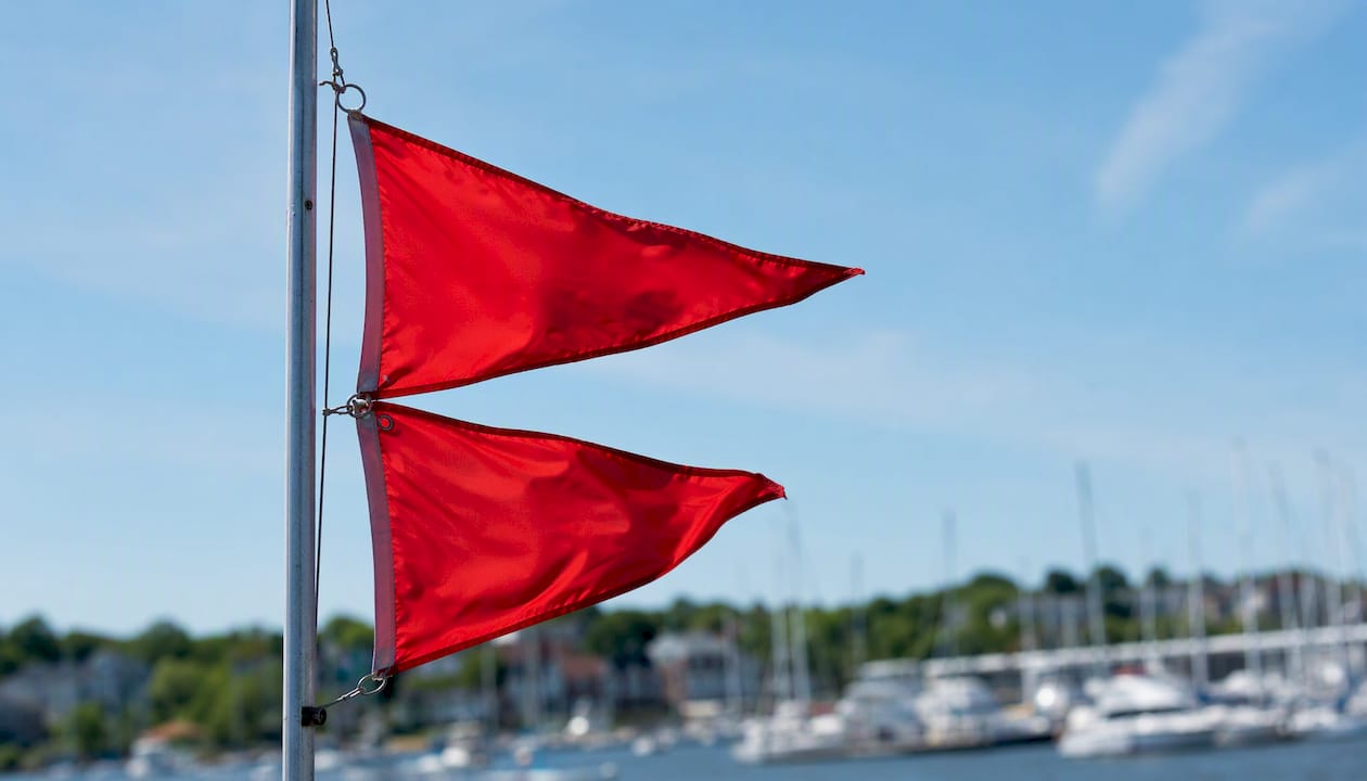
Flag signals remain part of the U.S. maritime system: two red pennants displayed at a marina or harbor indicate a gale warning. Flags are a useful visual cue, but they should never be your only source. Flags can be missed, obscured, or misread. Always cross-check against NWS products and VHF broadcasts before making a go/no-go decision.
Pro Tip: Program your VHF radio to scan the NOAA Weather Radio frequencies for your region before every trip. A 30-second listen before departure can confirm whether a gale warning is active or approaching.
What a gale warning means for your vessel
Gale-force winds reduce maneuverability, generate large breaking waves, and create conditions that can capsize small boats within minutes. Dock lines can snap. Anchors can drag. Even experienced mariners face life-threatening situations when caught in open water during a gale.
NWS meteorologists advise staying off the water entirely during a gale warning and treating the warning as lead time to reach safe anchorage, not a countdown to departure.
For small recreational boats (under 26 feet):
- Stay ashore. Do not launch.
- If already underway, head to the nearest safe harbor immediately.
- Ensure all aboard wear properly fitted life jackets.
- Secure the vessel at the dock with doubled lines and extra fenders.
For larger vessels or professional operators:
- Reduce speed and alter course toward shelter.
- Maintain a continuous VHF watch on Channel 16.
- Verify all emergency gear is accessible: EPIRBs, flares, life rafts.
- Notify the U.S. Coast Guard or a shore contact of your position and intentions.
Pro Tip: When time is short, prioritize in this order: seek shelter first, secure loose gear second, notify a shore contact third. Never reverse that sequence.
How a gale warning differs from related products
Not every severe weather alert carries the same weight. The numeric thresholds tell you exactly where you stand.
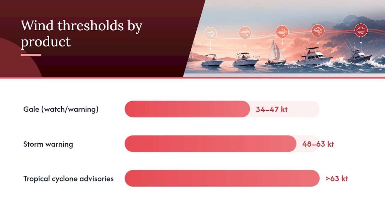
Warning hierarchy at sea: A gale warning (34–47 kt) is serious but not the top tier. A storm warning covers 48–63 knots. Above 63 knots, tropical cyclone advisories take over and replace all gale and storm warning products entirely.
The NOAA glossary draws a clear line between a gale watch and a gale warning: a watch means conditions are possible but timing and location remain uncertain, while a warning means gale-force winds are imminent or already occurring. A watch is your window to prepare; a warning is your signal to act.
| Product | Wind Threshold | Scope |
|---|---|---|
| Gale Watch | 34–47 kt possible | Marine; uncertain timing |
| Gale Warning | 34–47 kt imminent/occurring | Marine zones |
| Storm Warning | 48–63 kt | Marine zones |
| High Wind Warning | ~40 mph sustained / 58 mph gusts | Land areas (regional variation) |
Tropical cyclone advisories (tropical storm and hurricane warnings) supersede gale and storm warnings when a named storm is the cause.
Before, during, and after a gale: your checklist
Before:
- Check NWS marine forecasts and the Active Alerts portal for your zone.
- Top off fuel and inspect bilge pumps.
- Secure all loose gear on deck and below.
- File a float plan with a shore contact.
- Head to safe harbor before conditions reach gale threshold.
During:
- Don life jackets for all aboard.
- Maintain a VHF watch on Channel 16.
- Avoid exposed coastal waters and offshore passages.
- Reduce speed; consider heaving-to if offshore and unable to reach shelter.
- Keep bilge pumps running and communications open.
After:
- Inspect the hull, rigging, and dock lines for damage.
- Report any hazards (debris, damaged markers) to the Coast Guard.
- Document any incidents for insurance or safety records.
- Restock flares, first-aid supplies, and any emergency gear used.
Historical gale events that show what these conditions produce
The November 1975 sinking of the Edmund Fitzgerald on Lake Superior remains the most cited example of gale-force and storm-force conditions overwhelming a large commercial vessel. Sustained winds exceeded 50 knots and wave heights reached 25 feet, conditions that began under gale warning status before escalating.
On the East Coast, the “Perfect Storm” of October 1991 generated gale and storm warnings across the Gulf of Maine and Georges Bank. The combination of a nor’easter and a dying hurricane produced seas that overwhelmed multiple fishing vessels, including the Andrea Gail.
These events share a common thread: conditions that began as gale warnings and intensified faster than crews anticipated. Gale warnings are not a forecast of the worst-case scenario — they are the floor, not the ceiling.
Where gale warnings fit in the marine warning system
The NWS marine warning hierarchy runs from advisories at the low end through watches and warnings to special marine warnings for rapidly developing hazards. A gale warning sits in the middle tier: more severe than a small craft advisory (winds up to 33 knots) and less severe than a storm warning.
Special marine warnings (SMWs) are issued for short-duration hazards, such as thunderstorm squalls, that may produce gale-force gusts without a full gale warning being in effect. The full hierarchy, from least to most severe for sustained winds, runs: small craft advisory, gale warning, storm warning, and then tropical cyclone products.
Understanding this structure helps mariners calibrate their response. A small craft advisory warrants caution. A gale warning warrants stopping.
What experienced instructors know that most boaters overlook
Most recreational boaters underestimate how quickly gale conditions develop. A forecast showing 25-knot winds at departure can reach 40 knots within two hours as a frontal system accelerates. The instinct to “wait and see” is the most dangerous decision a small-boat operator can make.
One detail that certified instructors consistently emphasize: gale-force winds do not always arrive with visible storm clouds. Gales can originate from high-pressure systems and anticyclones, producing strong winds under clear or partly cloudy skies. Relying on visual cues alone is a critical error.
The seek-harbor-first mindset has to be practiced before it is needed. Mariners who have rehearsed their emergency procedures and know their vessel’s handling limits make better decisions under pressure. Pre-season drills in controlled conditions build the muscle memory that matters when conditions deteriorate fast.
Formal boating safety training builds gale-condition readiness
Knowing the thresholds is the starting point. Knowing what to do when conditions approach those thresholds is what certified boating safety training actually delivers.
Safeboatingamerica offers state-approved boating safety courses built on NASBLA-approved materials and taught by USCG-Licensed Captains. The curriculum covers weather-product literacy, VHF radio operation, emergency procedures, and navigation rules — the exact skills that determine outcomes when a gale warning is issued. Courses are available online, via live Zoom, and in-person across all U.S. states, with same-day certification options for many students. If you are a recreational boater, PWC operator, or first-time boat owner, register for a boating safety course and build the knowledge base that gale preparedness requires.
Sources
For immediate alerts while underway, NOAA Weather Radio and VHF Channel 16 are the primary sources. For background definitions and planning, the NWS Marine Definitions page and NOAA Glossary are the authoritative references.
FAQ
What does a gale warning mean?
A gale warning is an official NWS marine alert for sustained winds or frequent gusts of 34–47 knots (39–54 mph) not associated with tropical cyclones. Recreational boaters should seek safe harbor immediately when one is issued.
Is a gale warning worse than a storm warning?
No. A storm warning covers higher winds of 48–63 knots, making it more severe than a gale warning. Tropical cyclone advisories supersede both products when a named storm is the cause.
What is the difference between a gale and a storm?
In U.S. marine terminology, a gale covers 34–47 knots and a storm covers 48–63 knots. Both are distinct from tropical storm and hurricane classifications, which use separate advisory products.
Can you see a gale coming just by looking at the sky?
Not reliably. Gale-force winds can develop from high-pressure systems with little visible cloud cover, so visual observation alone is insufficient. Always verify conditions through NWS forecasts or NOAA Weather Radio before departure.