

OpenCPN for Boaters: Download, Setup, and Support

OpenCPN is a free, open-source chartplotter and marine GPS navigation application distributed under the GPL v2 license. Download the stable release directly from the official site or from the GitHub releases page. After installing, open the Quick Start Guide and the user manuals before anything else.
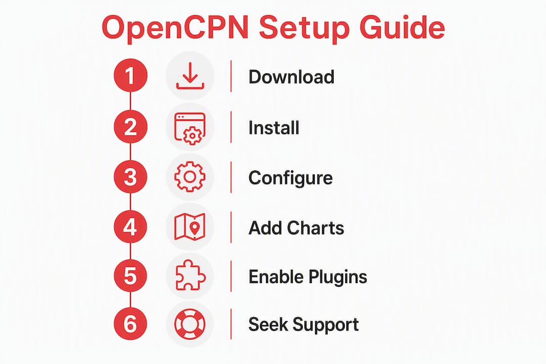
Immediate next steps:
- Download the stable release for your platform (Windows, macOS, Linux, Android)
- Source and install charts separately — OpenCPN ships with none preloaded
- Connect your GPS or AIS source through the Connections dialog
- Consult the official manuals and wiki before posting in community forums
Table of Contents
- What does OpenCPN actually do at the helm?
- Where can you download OpenCPN?
- How to install OpenCPN and set it up quickly
- Which chart formats does OpenCPN support?
- What plugins should you add to OpenCPN?
- Where do you find help and official documentation?
- How do you fix the most common OpenCPN problems?
- How do you build OpenCPN from source or contribute on GitHub?
- Does OpenCPN work on Android and tablets?
- Key Takeaways
- Who benefits most from OpenCPN — and who should think twice?
- Boating certification that pairs with your navigation setup
- Useful sources
- FAQ
What does OpenCPN actually do at the helm?
OpenCPN functions as a moving-map chartplotter. It plots your vessel’s position on a chart canvas in real time, manages waypoints, routes, and tracks, and overlays AIS targets from a connected receiver. Tide and current overlays are available through the plugin system.
Core capabilities:
- Moving-map display: Real-time position on raster or vector charts
- Route and waypoint management: Create, edit, and activate routes; log tracks automatically
- AIS overlay: Display nearby vessel traffic from a connected AIS receiver
- NMEA 0183/2000 input: Accepts GPS, depth, wind, and AIS sentences via serial, USB, or network gateway
- Plugin architecture: Optional features install separately, keeping the core lean and fast for helm visibility
The design philosophy matters here. OpenCPN was built by active sailors for real-world helm use, which explains why the core stays minimal. Advanced route analysis, passage planning databases, and weather routing are intentionally left to complementary tools rather than baked into the main application.
Pro Tip: Treat OpenCPN as the helm display. Use a dedicated passage-planning tool for pre-departure analysis, then import the finished route as a GPX file.
Where can you download OpenCPN?
The current stable release is version 5.14.0, published April 8, 2026, available as a service and maintenance release with platform-specific builds and SHA256 checksums for verification.
| Platform | Distribution Method | Notes |
|---|---|---|
| Windows | Installer (.exe) | SHA256 checksum provided; verify before running |
| macOS | Package (.dmg) | Notarized build; check release notes for macOS version requirements |
| Linux (Debian/Ubuntu) | PPA / backports | Also available as Flatpak for broader distro support |
| Raspberry Pi | ARM build | Useful for dedicated helm computers |
| Android | Google Play | Official distribution; no iOS version available |
For desktop installs, always verify the SHA256 checksum against the value published on the download page before running the installer. The GitHub releases page carries the same assets and is the preferred source when the official site is slow or unavailable.
Choose the stable release for any helm deployment. Beta builds are for testing new features at anchor, not for navigation underway.
How to install OpenCPN and set it up quickly
OpenCPN requires a few deliberate steps before it is ready for navigation. Charts are not preloaded, and GPS connections must be configured manually.
Installation steps by platform:
- Download the correct installer or package for your OS from opencpn.org or GitHub
- Run the installer (Windows/macOS) or follow the PPA/Flatpak instructions for Linux
- Launch OpenCPN — the chart canvas will be empty until charts are added
Loading charts:
- Go to Options > Charts > Chart Files and add the folder where your chart files are stored
- Click Apply, then allow the chart database to rebuild — this step is required and often missed by new users
- Confirm charts appear on the canvas by zooming to a charted area
Connecting GPS and AIS:
- Open Options > Connections and add a new data source
- Select the correct interface (Serial, USB, Network/TCP, or UDP) and set the baud rate (typically 4800 or 38400 for NMEA 0183)
- Enable the NMEA sentences you need (GGA, RMC for GPS; VDM for AIS)
- Confirm a position fix appears on the chart canvas — the vessel icon should move to your location
Creating a basic route:
- Select the Route tool from the toolbar
- Click waypoints on the chart canvas in sequence
- Right-click the final waypoint and select End Route
- Activate the route via the Route Manager to begin navigation guidance
Common quick checks if something fails to appear:
- Chart not visible: confirm the database rebuild completed and the file path is correct
- No GPS position: check serial port permissions (Linux users may need to add themselves to the
dialoutgroup), verify baud rate, and confirm the correct NMEA sentences are enabled - AIS targets missing: verify the AIS receiver is sending VDM sentences and the connection is active in the Connections dialog
Pro Tip: On Linux, run ls -l /dev/ttyUSB* to confirm the system sees your USB-serial adapter before configuring the Connections dialog.
Which chart formats does OpenCPN support?
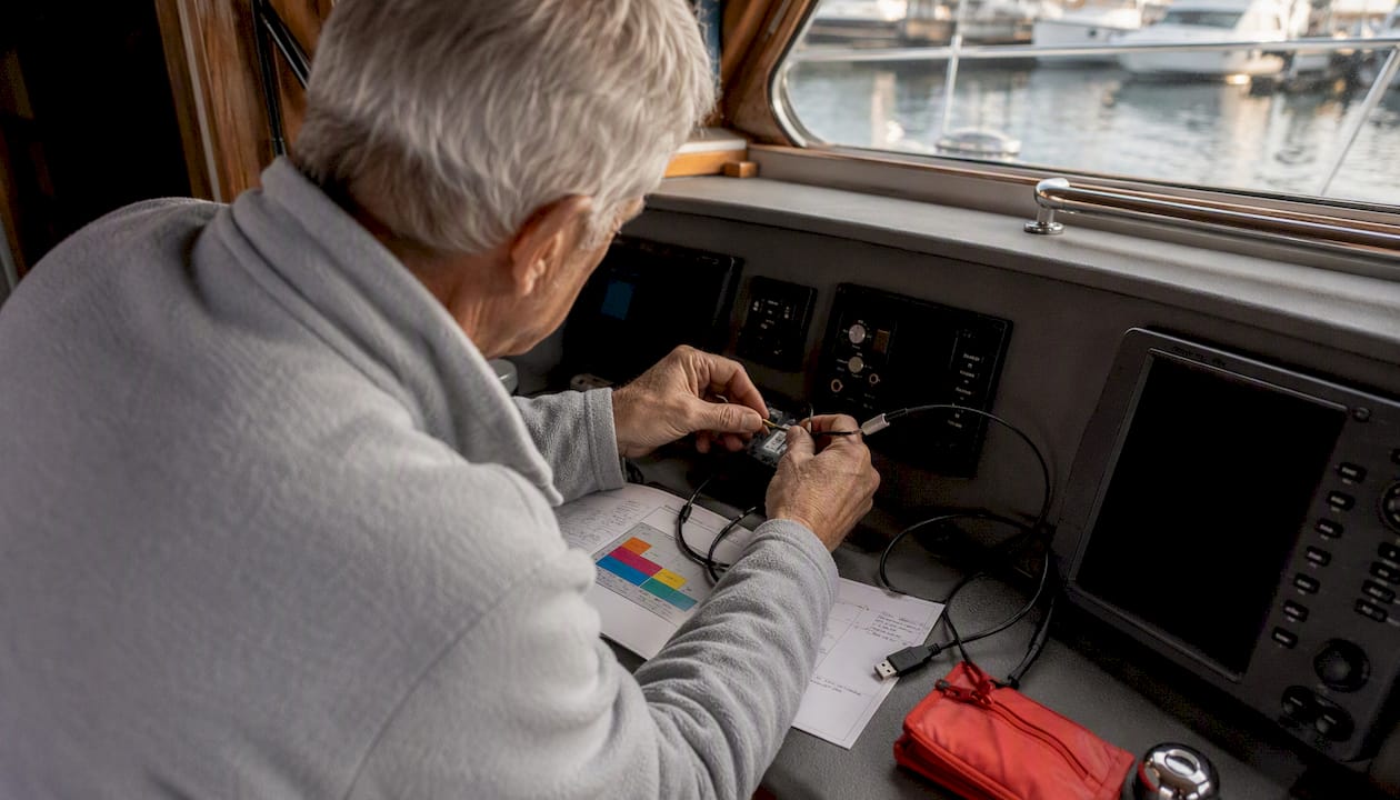
OpenCPN supports quilted raster and vector chart formats, plus tiled overlays. The table below summarizes the main categories.
| Chart Type | Format | Practical Notes |
|---|---|---|
| Raster (RNC) | BSB / KAP | NOAA raster charts; good for familiarity; larger file sizes |
| Vector (ENC) | S-57 / ENC | NOAA ENCs; scalable, object-queryable; preferred for precision |
| Tiled overlays | MBTiles | Satellite photo or custom tile overlays; not for primary navigation |
| Offline vector | — | Worldwide coverage; lower detail than official ENCs |
U.S. boaters: NOAA distributes both raster nautical charts (RNC) and electronic navigational charts (ENC/S-57) free of charge at the NOAA Office of Coast Survey. These are the recommended chart sources for U.S. waters and install directly into OpenCPN’s chart directory.
Navionics compatibility: Navionics charts are proprietary. OpenCPN cannot natively load Navionics chart files. Some third-party tile or photo overlays can be displayed via MBTiles, but full Navionics vector chart data requires a Navionics-compatible device or application. If you rely on Navionics for your cruising area, plan to use NOAA ENCs in OpenCPN and keep Navionics on a separate device.
What plugins should you add to OpenCPN?
Plugins extend OpenCPN without adding weight to the core install. The Plugin Manager, accessible under Options > Plugins, handles installation and updates.
Commonly used plugin categories:
- Instrument panels: Dashboard plugin displays speed, depth, wind, and heading in configurable gauges
- Weather and GRIB: GRIB2 weather overlay plugin pulls forecast wind, pressure, and wave data for passage planning
- Radar overlay: Navico/Garmin radar plugins integrate compatible radar returns directly onto the chart canvas
- AIS enhancements: Additional AIS filtering and alert plugins for busy anchorages or shipping lanes
- Tidal data: Tide and current prediction plugins using harmonic data for U.S. and international stations
Performance degrades when too many plugins run simultaneously, particularly on low-power hardware like Raspberry Pi. Stability also depends on plugin version compatibility with the installed OpenCPN release.
Pro Tip: Enable one new plugin at a time, then run OpenCPN for a full session at anchor before relying on it underway. A plugin that crashes the application at sea is worse than no plugin at all.
Where do you find help and official documentation?
The OpenCPN wiki and manuals are the recommended first stop before posting in any forum. Most configuration questions — GPS not found, chart database issues, plugin conflicts — are already documented with step-by-step solutions.
Official resources:
- OpenCPN Manuals: User manual, Quick Start Guide, plugin manual, and developer guide; available as epub, PDF, and bundled with the application
- OpenCPN Wiki: — Searchable reference covering every dialog, connection type, and plugin; the fastest path to a specific answer
- OpenCPN basic manual: Step-by-step coverage of core functions; start here for initial configuration
Community channels:
When posting for help, include: your operating system and version, OpenCPN version number, a description of the exact behavior, and any relevant log output from Help > Show Log File.

Pro Tip: Search the wiki with the exact error message text before opening a forum thread. The wiki’s search function indexes the full manual and often surfaces the fix in under a minute.
How do you fix the most common OpenCPN problems?
Most setup failures fall into three categories: GPS not found, charts not displaying, and plugin conflicts.
GPS not showing position:
- Confirm the device appears in your OS (Device Manager on Windows;
dmesgor/dev/ttyUSB*on Linux) - Check baud rate — NMEA 0183 defaults to 4800 baud; some devices use 38400
- Verify GGA and RMC sentences are enabled on the GPS device
- On Linux, confirm your user account belongs to the
dialoutgroup - Check firewall rules if using a network GPS (TCP/UDP source)
Charts not displaying:
- Rebuild the chart database after adding or moving chart files (Options > Charts > Apply)
- Confirm the chart file path is correct and the files are not inside a zip archive
- Check the zoom level — some charts only appear within a specific scale range
- Enable “Quilted” display mode to allow OpenCPN to blend adjacent chart cells
Plugin conflicts and slowdowns:
- Disable the most recently added plugin and restart OpenCPN to isolate the issue
- Check Help > Show Log File for error messages tied to a specific plugin
- Reduce the number of active plugins on low-power hardware
Pro Tip: Keep a note of which plugins were active when the application was last stable. If a new plugin causes problems, that baseline list is your fastest path back to a working configuration.
How do you build OpenCPN from source or contribute on GitHub?
The OpenCPN GitHub repository hosts source code, release assets, and development discussion. Release notes for each version list changes, fixed bugs, and SHA256 checksums for all platform builds.
Contributing to OpenCPN starts with reading the repository’s CONTRIBUTING file and coding style guide before submitting a pull request. The maintainers expect issue reports to include platform, version, steps to reproduce, and log output — the same information the community asks for in forum posts.
| Build Target | Recommended Packaging | Toolchain Notes |
|---|---|---|
| Windows | NSIS installer | MSVC or MinGW; CMake build system |
| macOS | .dmg package | Xcode / Clang; CMake |
| Linux (general) | Flatpak | Broadest distro compatibility |
| Debian / Ubuntu | PPA / backports | Native .deb packaging |
| Raspberry Pi | ARM binary | Cross-compile or native build on Pi hardware |
For most contributors, the fastest path to a working build is the Flatpak manifest, which handles dependencies consistently across Linux distributions. Windows and macOS builds require the platform SDK and CMake. Report confirmed bugs via the GitHub Issues tracker using the provided issue template; pull requests should reference the issue they address.
For advanced helm installations, the custom yacht build process guide from Yacht Consulting Group covers system integration considerations relevant to embedding OpenCPN into a bespoke navigation setup.
Does OpenCPN work on Android and tablets?
The official Android app is distributed through Google Play. There is no official iPhone or iOS version as of current releases.
Key differences and limitations on Android:
- Performance: — Mid-range and higher Android tablets handle OpenCPN adequately; budget ARM devices may struggle with large chart databases or multiple overlays
Pro Tip: For a reliable tablet helm station, use a rugged Android tablet with a clean, dedicated 12V power supply and a Wi-Fi NMEA 2000 gateway. This eliminates USB connection instability and keeps the tablet charged during long passages.
Key Takeaways
OpenCPN is free, cross-platform, and community-supported — the stable release, properly configured with NOAA charts and a GPS connection, delivers a capable helm display at zero software cost.
| Point | Details |
|---|---|
| Free and open-source | OpenCPN is distributed under the GPL v2 license with no purchase required. |
| Stable release 5.14 | Download from opencpn.org or GitHub; verify the SHA256 checksum before installing. |
| Charts are not included | Source NOAA raster or ENC charts separately and rebuild the chart database after adding them. |
| Community-driven support | Use the official wiki and manuals first; CruisersForum and Reddit r/sailing for community help. |
| Safeboatingamerica training | Pair OpenCPN with a state-approved boating safety course to build the navigation and rules-of-the-road skills the software assumes you already have. |
Who benefits most from OpenCPN — and who should think twice?
OpenCPN rewards skippers who are willing to configure their own system. The learning curve is real: you manage connections, install charts manually, and troubleshoot through community forums rather than calling a manufacturer’s support line. That tradeoff is entirely reasonable for a skipper who wants a configurable, low-cost helm display and has the patience to set it up correctly.
Where OpenCPN falls short is for boaters who expect a plug-and-play experience comparable to a factory chartplotter. A Garmin or Raymarine unit comes preconfigured, with charts loaded, vendor support, and a warranty. OpenCPN offers none of that. The software is genuinely excellent, but it is a tool for engaged users, not a turnkey product.
The gap most new OpenCPN users underestimate is not technical — it is navigational. The software displays your position and your route. It does not teach you how to read a chart, interpret tidal current data, apply collision regulations, or make sound decisions in restricted visibility. Those skills come from training, not software. Pairing OpenCPN with formal boating safety education closes that gap and makes the tool genuinely useful rather than just installed.
Boating certification that pairs with your navigation setup
OpenCPN gives you the display. Safeboatingamerica gives you the skills to use it safely and legally.
Safeboatingamerica offers state-approved boating license and safety certification courses across all U.S. states, taught by USCG-Licensed Captains and State Certified Instructors using NASBLA-approved materials. Courses cover chart reading, navigation rules, collision regulations, and emergency procedures — the exact knowledge base that makes a chartplotter like OpenCPN a genuine safety asset rather than just a screen showing a moving dot. Online, live Zoom, and in-person options are available, with same-day certification in many states.
Whether you need a California boating certification, a New Jersey boating license, or a course in any other state, Safeboatingamerica has a format that fits your schedule. Register for a course and get certified before your next passage.
Useful sources
| Resource | Description |
|---|---|
| OpenCPN Official Site | Main download hub, news, and project overview |
| Download OpenCPN | Platform-specific installers, release notes, and SHA256 checksums |
| OpenCPN Manuals | User manual, Quick Start Guide, plugin manual, and developer guide |
| OpenCPN Wiki | Searchable reference for configuration, plugins, and troubleshooting |
| GitHub Repository | Source code, issue tracker, and pull request submissions |
| GitHub Releases | Release assets, changelogs, and SHA256 checksums for all platforms |
| Quick Start Guide | Step-by-step install, chart loading, and GPS setup instructions |
| CruisersForum | Primary community forum for OpenCPN discussion and troubleshooting |
| Reddit r/sailing | Community discussion including OpenCPN use cases and comparisons |
FAQ
Is OpenCPN free to use?
Yes. OpenCPN is distributed under the GPL v2 license at no cost. Both the application and its source code are freely available from opencpn.org and GitHub.
What exactly is OpenCPN?
OpenCPN (Open Chart Plotter Navigator) is a free, open-source maritime chartplotter and navigation application developed by active sailors for real-world helm use. It supports GPS input, AIS overlay, route planning, and multiple chart formats.
Can OpenCPN use Navionics charts?
No. Navionics charts are proprietary and cannot be loaded natively into OpenCPN. U.S. boaters can use free NOAA raster (RNC/BSB) and vector (ENC/S-57) charts as a direct alternative.
Does OpenCPN work on Android?
Yes. The official Android app is available on Google Play. There is no official iOS or iPhone version as of current releases.
Where should I look first if OpenCPN is not working?
Check the OpenCPN basic manual and wiki before posting in forums. Most GPS, chart display, and plugin issues are already documented with step-by-step fixes.